
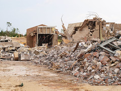
The satellite photo above where you see the path of the tornado is of the Alberta Elementary School from DigitalGlobe-Imagery. The two photos below that are Alberta Elementary School from the ground. DIgitalGlobe has uploaded more photos where you can literally see how the tornado scared the earth.


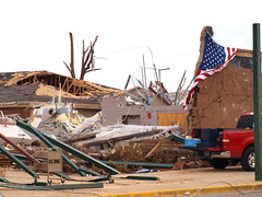
“A slew of powerful tornadoes ripped through the South last week, leveling entire towns and killing hundreds of people in six states. NOAA’s Storm Prediction Center was able to give 24 minutes’ notice of the approaching tornadoes, but for many people throughout the region, that wasn’t enough time to escape the deadly twisters.
For more information and to find out how to help, see the full article on Yahoo! News.
Photos from DigitalGlobe-Imagery, The Crimson White, SepiaBillo, and southerntabitha.