Flickr’s great for exploring photos by photographer, tag, time, text and group, and it’s also great for exploring photos by place. Adding geo data is a way for our members to organize their memories (that trip we took to Europe last year) and share their experiences with other members.
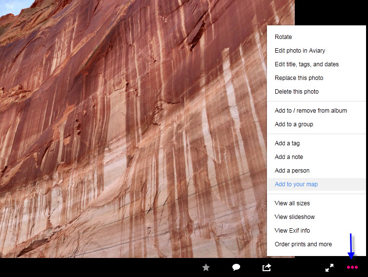
Today, we’ve added an easy-peasy way of adding geo data without having to leave the comfort of your own photo page. On the right side of your photo, click the three-circles icon and you’ll see “Add to your map” link in the pop-up menu, it’ll open a map which you can literally pin your photo on.
(If you’ve never geo-tagging before, the first time will point you to the organizr to pick your geo-settings.)
As the odds are you know more about your local neighborhoods than we do, when you edit a location on the pop-up map, you can also see other nearby options and choose one. Over time, if everyone continuously tells us we’ve got somewhere wrong, we can feed it back into the system and update it for everyone else. We’ll all stand united, hands joined across the world, singing and taking photographs in perfect world geo-tagging harmony*, la la la la … [fade to black].
*or something like that.