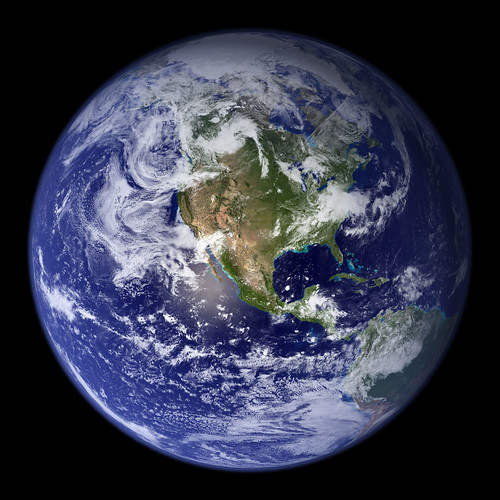
You probably have seen the famous photo of Earth taken by the crew of Apollo 17 in 1972, which shows most of Antarctica, Africa and the Saudi Arabian peninsula. Well, we can add more amazing photographs to the ‘Blue Marble’ series. NASA’s Goddard Space Flight Center has released these beautiful images to the public, showing gorgeous detail of our planet.
This spectacular “blue marble” image is the most detailed true-color image of the entire Earth to date. Using a collection of satellite-based observations, scientists and visualizers stitched together months of observations of the land surface, oceans, sea ice, and clouds into a seamless, true-color mosaic of every square kilometer (.386 square mile) of our planet. These images are freely available to educators, scientists, museums, and the public. This record includes preview images and links to full resolution versions up to 21,600 pixels across.
Update: Just posted was a lovely animation of the spinning Earth.
Photos by Goddard Photo and Video Blog.

